Saturday, November 20, 2010

The Changing Coastline of Wan Chai

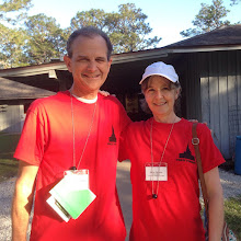
Craig standing in front of the boulder that the Hung
Shing temple was built around; the incinerator back
there is used to burn paper models of nice items to
somehow send the real things up to ancestors.
Lowell & Susan Bishop, who serve as temple missionaries here, joined us for a walking tour of the fascinating land reclamation that has added valuable space along the harbor coastline, an endeavor that began in 1890 and goes on today. We saw three buildings which were on the original coastline: the 1913 Post Office, the 1872 Blue Building, and the Hung Shing temple which is build against the boulder that had been an altar on the shore in the 1800's. See a map and read about it here:  http://www.discoverhongkong.com/eng/things-to-do/images/wanchai-ever-changing-landscape.pdf (the Wan Chai police station shows up on this particular map and the building where we serve, the Church Administration building, is next door on the corner of Gloucester and Fleming).
That taxi is driving where water used to be, and this old Post
Office was originally squeezed between the coastline and
the rocky hills behind it. 

One of Hong Kong's oldest structures that has not been
razed to make way for skyscrapers, the Blue Building
is awaiting renovation. Note the original street sign
stuck to the side of the building.

For a simple but cool animation of how the coastline has changed: http://upload.wikimedia.org/wikipedia/commons/d/d2/Wanchaireclamation.gif

No comments:

Post a Comment